File:Egypt region map scaled.png
From A Wiki in the Desert
Revision as of 19:05, 28 September 2019 by Cegaiel (talk | contribs) (Cegaiel uploaded a new version of File:Egypt region map scaled.png)
Size of this preview: 298 × 598 pixels. Other resolutions: 119 × 240 pixels | 239 × 480 pixels | 299 × 600 pixels | 800 × 1,606 pixels.
Original file (800 × 1,606 pixels, file size: 2.2 MB, MIME type: image/png)
File history
Click on a date/time to view the file as it appeared at that time.
| Date/Time | Thumbnail | Dimensions | User | Comment | |
|---|---|---|---|---|---|
| current | 06:16, 20 November 2023 | | 800 × 1,606 (2.2 MB) | Cegaiel (talk | contribs) | |
| 05:02, 18 November 2023 |  | 800 × 1,606 (2.19 MB) | Cegaiel (talk | contribs) | ||
| 05:01, 18 November 2023 |  | 1,020 × 2,048 (2.41 MB) | Cegaiel (talk | contribs) | ||
| 02:26, 8 November 2023 |  | 800 × 1,606 (2.19 MB) | Cegaiel (talk | contribs) | ||
| 02:16, 8 November 2023 |  | 1,020 × 2,048 (2.41 MB) | Cegaiel (talk | contribs) | ||
| 19:05, 28 September 2019 | 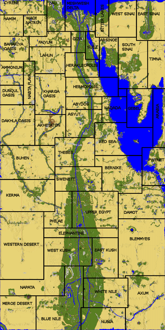 | 625 × 1,250 (690 KB) | Cegaiel (talk | contribs) | ||
| 04:20, 28 September 2019 |  | 625 × 1,250 (691 KB) | Cegaiel (talk | contribs) | ||
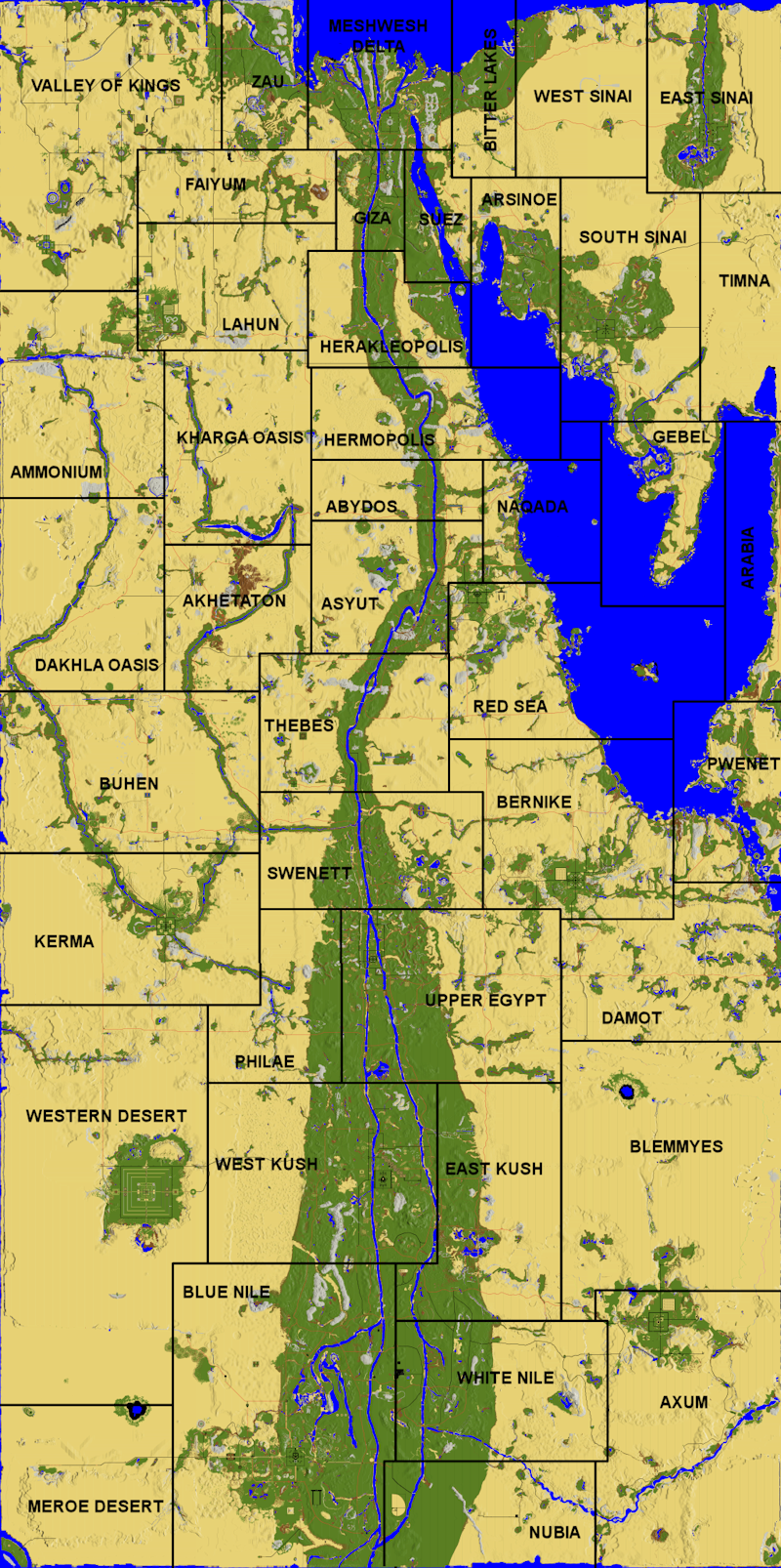
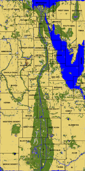
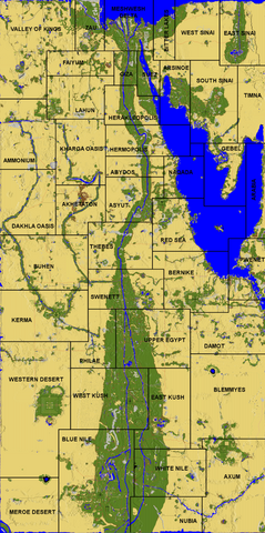
| 08:47, 19 February 2018 | 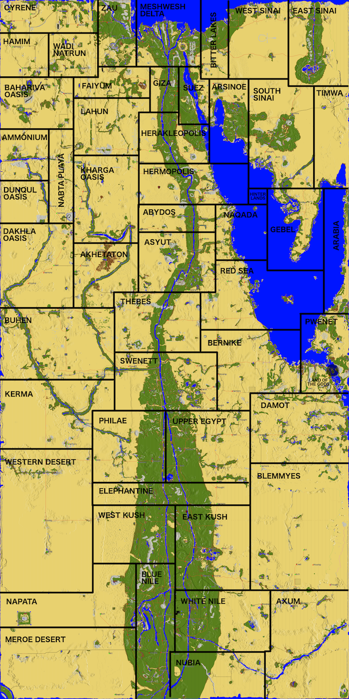 | 700 × 1,400 (1.83 MB) | Shams (talk | contribs) | This map was made by taking the colorful thumbnail provided by Malard, scaling it up onto a full Egypt map, drawing the outlines, then labeling them. The lines are not coordinate-perfect. This is just for reference. |
You cannot overwrite this file.
File usage
The following 6 pages use this file: